


Martin Township Voting District, Smith County, Kansas
About
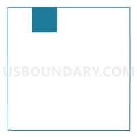
Outline

Summary
| Unique Area Identifier | 587416 |
| Name | Martin Township Voting District |
| County | Smith County |
| State | Kansas |
| Area (square miles) | 35.79 |
| Land Area (square miles) | 35.66 |
| Water Area (square miles) | 0.13 |
| % of Land Area | 99.63 |
| % of Water Area | 0.37 |
| Latitude of the Internal Point | 39.97782140 |
| Longtitude of the Internal Point | -98.90365690 |
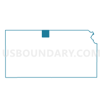
Maps

Graphs
Select a template below for downloading or customizing gragh for Martin Township Voting District, Smith County, Kansas


Neighbors
Neighoring Voting District (by Name) Neighboring Voting District on the Map
- Beaver Township Voting District, Smith County, KS
- East Franklin Precinct, Franklin County, NE
- German Township Voting District, Smith County, KS
- Pleasant Township Voting District, Smith County, KS
- Swan Township Voting District, Smith County, KS
- Washington Township Voting District, Smith County, KS
- West Franklin Precinct, Franklin County, NE
Top 10 Neighboring County Subdivision (by Population) Neighboring County Subdivision on the Map
- East Bloomington township, Franklin County, NE (252)
- Washington township, Franklin County, NE (123)
- Washington township, Smith County, KS (57)
- Beaver township, Smith County, KS (48)
- Swan township, Smith County, KS (48)
- Pleasant township, Smith County, KS (37)
- German township, Smith County, KS (30)
- Martin township, Smith County, KS (18)
Top 10 Neighboring Unified School District (by Population) Neighboring Unified School District on the Map
- Smith Center Unified School District 237, KS (2,910)
- Franklin Public Schools, NE (1,873)
- Unified School District 110, KS (1,681)